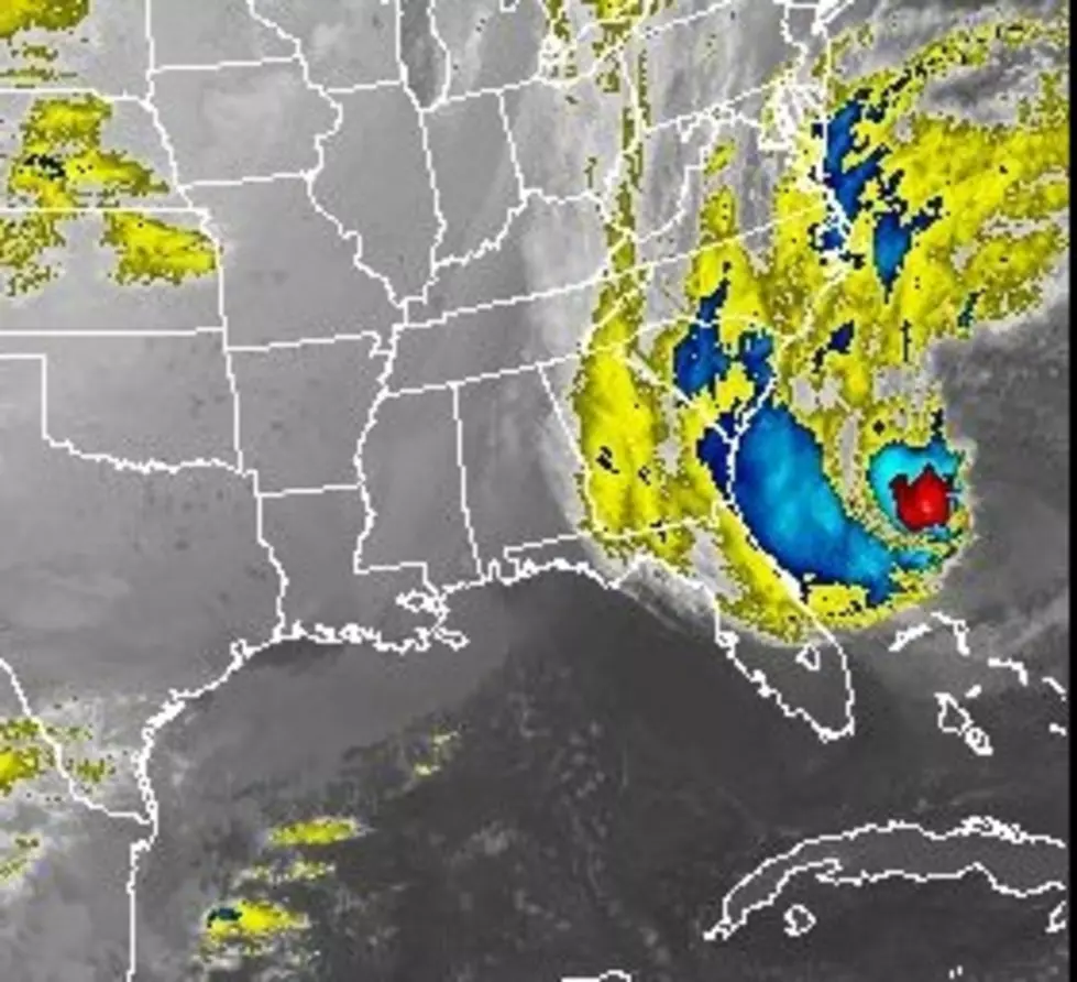
Track Hurricane Sandy as it Heads For Buffalo
It seems pretty much a lock that we are going to get some heavy rains from what is going to be left of Hurricane Sandy. The storm is very large, and most of the forecasts call for Western New York to be impacted by the beginning of the week.
According to the National Weather Service:
The center of Tropical Storm Sandy will move parallel to the southeast coast of the United States through the weekend. Sandy is a very large tropical cyclone with tropical storm force winds extending outward up to 450 miles. The latest forecast indicates a turn to the northwest by early next week, with direct impacts expected for the Mid-Atlantic and/or Northeast United States.
If you would like to track Hurricane Sandy as it heads for Buffalo, there is a link below to the satellite imagery.
More From 106.5 WYRK


![10 Barn Weddings You Can Have in Western New York [LIST]](http://townsquare.media/site/10/files/2016/05/Barn-Weddings-Getty.jpg?w=980&q=75)

![Look Where Buffalo Ranks in Top 10 Tailgate Cities [LIST]](http://townsquare.media/site/10/files/2015/10/Buffalo-Bills-Tailgating.png?w=980&q=75)
![The 6 Most Infamous Serial Killers From Buffalo and WNY! [List]](http://townsquare.media/site/11/files/2016/03/Police-Tape.jpg?w=980&q=75)
![5 Places That The Rest of America Wants From Buffalo [LIST]](http://townsquare.media/site/10/files/2019/10/RS9901_100538196.jpg?w=980&q=75)