Lake Effect Snow For Many Parts of New York State
There's only a week or so left in the month of January, and everyone is already looking forward to what is hopefully a warmer February. January has been downright cold and has brought a lot of snow to the state; especially off Lake Erie and Lake Ontario.
This weekend will feature more bitterly cold temperatures and lake effect snowfall.
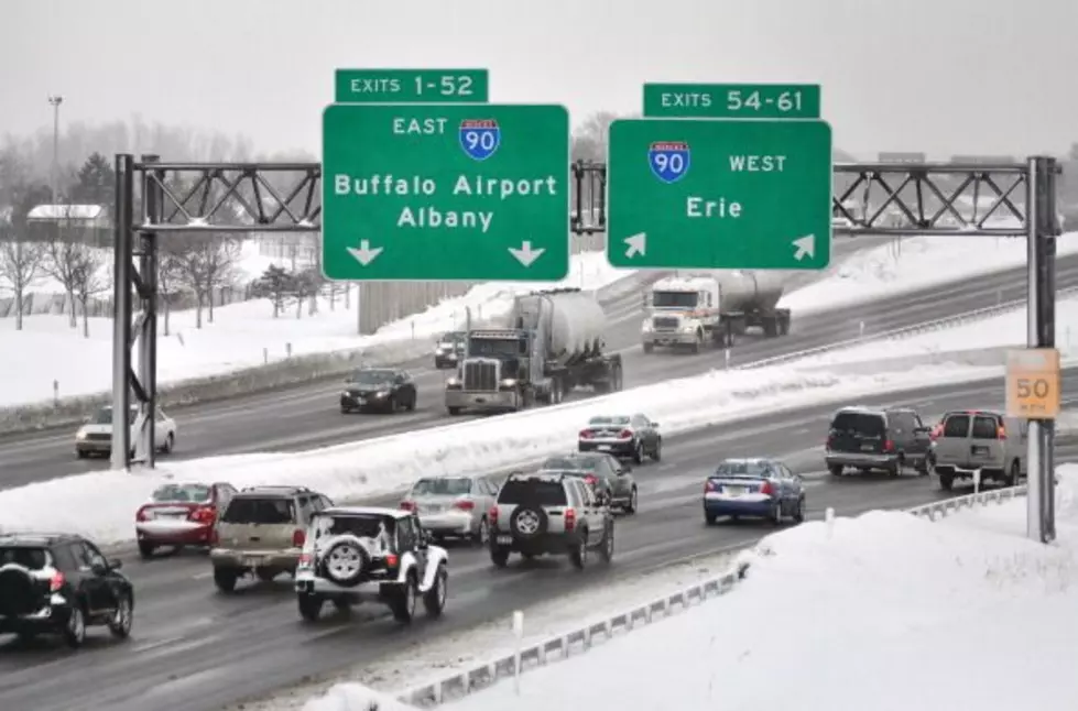
Lake effect snow will impact many parts of New York State this weekend through Sunday afternoon, and it really all depends on where you live, when figuring out how much accumulating snow you will receive.

Regions off Lake Erie will see snow and more snow the further south you go. The southern tier portion of Western New York could see as much as 6 inches of snow, while Buffalo and suburbs surrounding could see 1-2 inches.
Central New York and regions near the Finger Lakes could see some snow, but not major accumulations.
Regions off Lake Ontario will see the most snow. In fact, it will likely be snow that could severely impact travel.
According to the National Weather Service, lake effect snow will set up off Lake Ontario and bring anywhere from 8-12 inches of snow near Watertown and just north of Pulaski, which could see at least 6 inches of snow.
It all depends where the lake effect snow band(s) set up.
There's a Lake Effect Snow Warning in effect for Jefferson County, with Lake Effect Snow advisories in effect for Lewis and Oswego counties. There's also a Lake Effect Snow Advisory for the southern tier, here in Western New York.
Drive carefully if you are traveling in these areas this weekend.
24 Amazing Pictures Of The Snowfall In The Last 24 Hours In WNY
Gallery Credit: Brett Alan
Most Overrated Places In New York State
9 Most Underrated Places in New York State
Top 40 Winter Restaurants in Buffalo
37 Restaurants Serving The Most Mouth-Watering Steaks In WNY
Gallery Credit: Brett Alan
LOOK: Food history from the year you were born
Gallery Credit: Joni Sweet
50 Most Popular Chain Restaurants in America
Gallery Credit: Paul Feinstein
LOOK: Here is the richest town in each state
Gallery Credit: Meagan Drillinger
LOOK: Things from the year you were born that don't exist anymore
Gallery Credit: Stacey Marcus
More From 106.5 WYRK