Several Winter Storms Coming Through New York This Week
It looks like Mother Nature is ending the month of January like Elsa from "Frozen", with plenty of icy cold weather.
Fun After A Long Day At Work. Listen To Dave Fields Afternoons 3-7pm
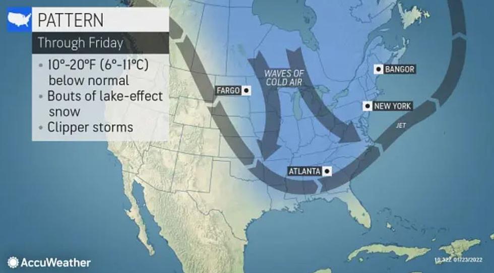
This week there are several winter storm fronts also known as Alberta Clippers that will move across Canada and bring cold air and snow across New York State. The storms will come down from the upper western part of Canada before sweeping across the midwest of the United States and bringing cold air to parts of New York.
According to Accuweather, the quick-moving winter storms could also bring sleet, freezing rain, and lake effect snow to parts of New York State. Depending on where you are in New York State, you could get a couple of inches to over 6 inches if the lake effect snow picks up.
Most of the snow will impact Western New York Monday night through Tuesday before heading East and bringing the snow flurries to Syracuse and Binghamton later this week.
The artic weather will also bring below-average temperatures to the state for much of the week. We could see temperatures that are 10-20 degrees below normal for this time of the year.
We could see the temperatures drop to single digits for highs later this week with the lows falling below zero. The Wind Chill could make those temperatures feel like -10 or more.
The storms could become more impactful in the Southern Tier if the Jet Stream drops a little bit this week, if not most of the snow and cold weather will stay Upstate and could impact travel along the 90 from Buffalo to Albany.
Several Winter Storms Coming Through New York This Week
Gallery Credit: Dave Fields
Snowblower Etiquette Every New York Should Know
Gallery Credit: Dave Fields
5 Ways To Relieve Sore Muscles After Shoveling Snow
Gallery Credit: Dave Fields
More From 106.5 WYRK