80 mph Wind Gusts Possible for Parts of New York State
The weather will be rather unsettled over the next few days in New York.
Late March and early April is typically a time of the year for major temperature swings. The forecast battles it out between warmer days, such as 50-60 degree temperatures, or 30-40 degree temperatures and even snow and wind.
For Western New York, the brunt of an upcoming storm will be felt this weekend.
After a brief disturbance on Wednesday, most everyone will get a quiet weather day on Thursday, before a huge change is expected on Friday and Saturday.

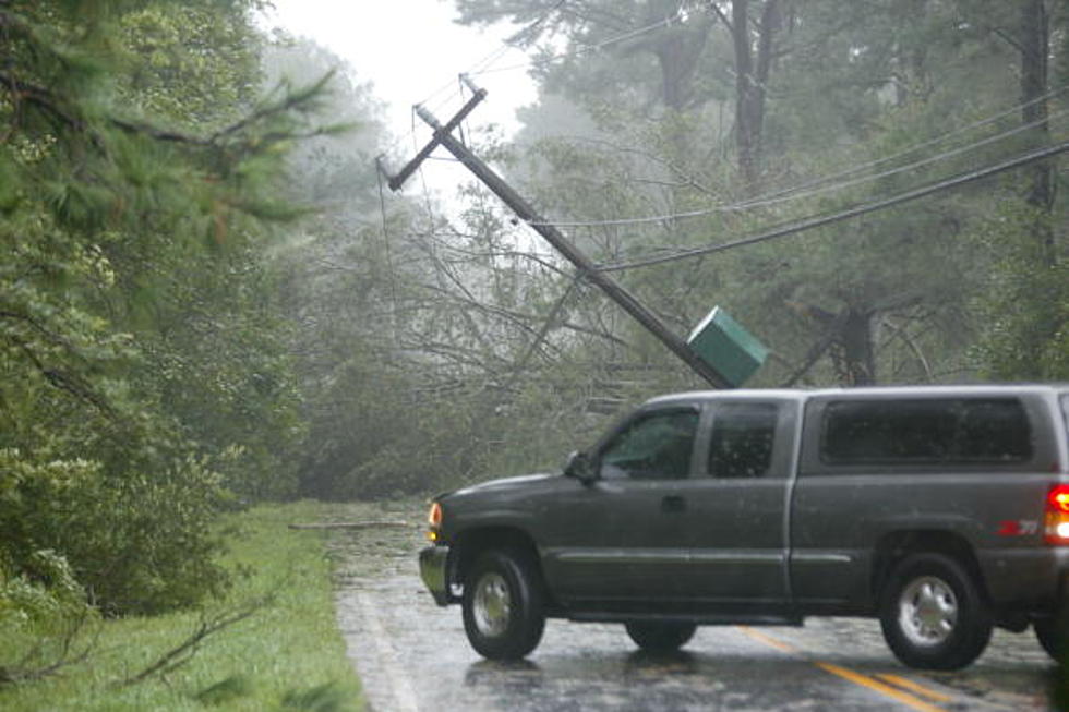
Rain moves in Friday during the morning, before becoming extremely windy during the evening hours and by Saturday, that wind could pose a serious threat. Power outages and other wind-related damage is expected with this storm, as gusts are likely to top 70 mph and could potentially even reach 80 mph in some places in Western and Central New York.
Those are hurricane-like wind speeds.
The entire state will see major wind gusts but Western New York being right off Lake Erie will see even larger wind gusts. Rain and snow will accompany this system and bring awful weather to the region this weekend.
The good news is Sunday looks dry and sunny, albeit, cold. High temperatures will be in the low 40's.
For this Wednesday (tomorrow), wind gusts will be approaching 50 mph, so really we have two days of major wind gusts we will have to contend with.
Make sure to bring anything inside that could pose a threat to blow away. Also be prepared to lose power with these systems, especially on Friday night and into Saturday.
The 5 Deadliest Tornados In New York State History
Gallery Credit: Dave Fields
25 'Safest' Hometowns in New York State
Your Ghost Guide to The 50 Most Haunted Places in New York State
Gallery Credit: Traci Taylor
More From 106.5 WYRK